served from maproom.meteorwanda.gov.rw
max ∂sl [ Rwanda RAB soil AWC_d ] : ∂sl Available soil water capcity data
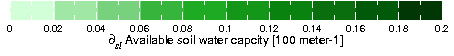
soil AWC_d partial_sl ∂sl Available soil water capcity from Rwanda RAB: Rwanda Agricultural Board.Independent Variables (Grids)
- Latitude (latitude)
- grid: /Y (degree_north) ordered (2.84375S) to (1.058036S) by 0.008928572 N= 201 pts :grid
Other Info
- CE
- 0.2
- colorscalename
- prcp_0to1000_colors
- CS
- 0
- datatype
- realarraytype
- file_missing_value
- 1.00000003E32
- maxncolor
- 254
- missing_value
- NaN
- units
- 100 meter-1
- history
- max over X[28.86161E, 30.88839E] sl[22.5 cm, 150.0 cm]
- colorscale
Last updated: Tue, 17 Mar 2020 13:52:02 GMT
Data Views
Filters
Here are some filters that are useful for manipulating data. There are actually many more available, but they have to be entered manually. See Ingrid Function Documentation for more information.- Monthly Climatology calculates a monthly climatology by averaging over all years.
- anomalies calculates the difference between the (above) monthly climatology and the original data.
- Integrate along Y
- Differentiate along Y
- Take differences along Y
RMS (root mean square with mean *not* removed) over Y |
RMSA (root mean square with mean removed) over Y |
Maximum over Y |
Minimum over Y |
Detrend (best-fit-line) over Y |
Note on units